

Mount Pleasant to Charleston, South Carolina

Cooper River Bridge Run

6.2 mi

Make two travel plans for this 10K. You need to reach your wave in Mount Pleasant before the race and get home from downtown Charleston afterward. The pin you send your driver depends on which trip they’re helping with.

See sample training weeks

Where should I leave my car if the finish is across the river?

One option is the North Charleston Convention Center at 5001 Coliseum Drive. Wear your bib to board the bus to the start. For 2027 the organizer lists outbound buses from 5:00 to 6:45 a.m. and return buses from downtown Charleston from 10 a.m. to 1 p.m. Before boarding in Charleston, ask the driver whether the bus returns to 5001 Coliseum Drive.

Bus routes, return trips and bridge sweep

I get into town late. Can a friend pick up my bib?

Yes. For the 2027 Bridge Run, your friend can collect your packet at the expo with a digital or paper copy of your ID. Send your bib number along when the race emails it. The organizer rules out Saturday pickup, so settle this before your friend leaves the expo. Then arrange the handoff before you need the bib to board your shuttle.

Bridge Run packet pickup and participant questions

If I walk the bridge, which deadline should I check?

The sweeper bus starts up the Ravenel Bridge at 10:30 a.m. from Patriots Point Road and Coleman Boulevard. The bridge reopens at 11. Count the minutes from your wave’s start to 10:30. That time has to cover the approach as well as the crossing. Use a walking pace that includes any stops you expect to take.

Bus routes, return trips and bridge sweep
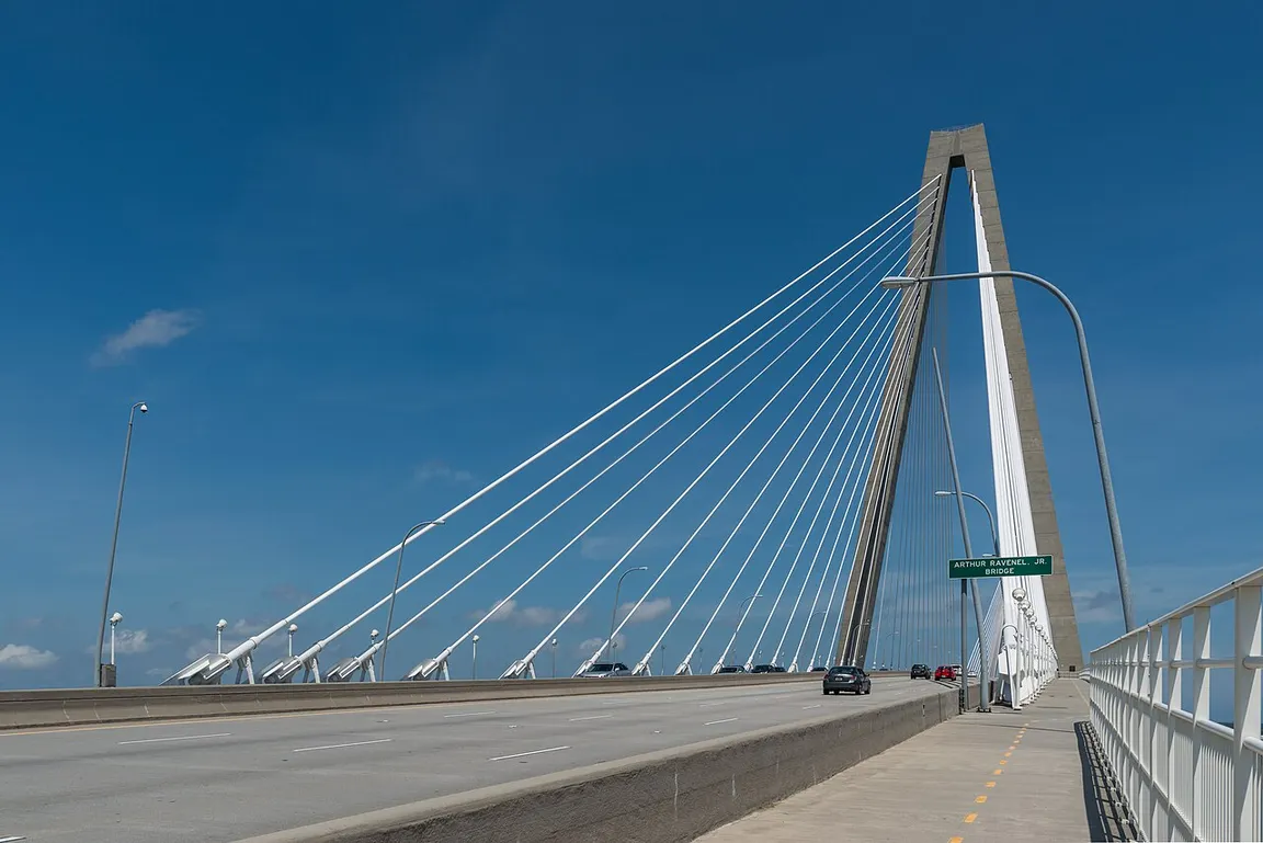
The bridge roadway rises toward a cable-stayed tower above the Cooper River.
The Ravenel Bridge deck from the west side. Include the approach from the start when you estimate how long the crossing will take.DXR · CC BY-SA 4.0 · Resized

What map should I send the person meeting me after the run?

Send the finish-area map to the person meeting you in Charleston. Keep the wave-start map for yourself in Mount Pleasant. Pick a named street corner outside the finish area and agree which side you’ll stand on. Before you put your phone away, make sure both of you can point to the same spot on the map.

Cooper River’s start, course and finish maps
Watch the videoVIDEO: Start of The Cooper River Bridge Run with Simone Roberts
Play video
Live 5 News | The Lowcountry's News Leader · YouTube VIDEO: Start of The Cooper River Bridge Run with Simone Roberts

If you started today

See how your week could change between now and race day.

Example for 12 mi a week, a longest outing of 5 mi, and 3 available days.

Week of Nov 16Starting week5.5 mi

Your first available days, starting today.

  • Long run · 5.5 mi
Week of Jan 25Build week20.0 mi

A look at your running once the routine is underway.

  • Rest
  • Easy run with strides · 6.0 mi
  • Rest
  • Hills 6×45 s · 6 mi
  • Rest
  • Rest
  • Long run · 8.0 mi
Week of Mar 29Race week12.2 mi

The final outings and the race itself.

  • Rest
  • Sharpener 4×1′ · 3 mi
  • Rest
  • Easy run · 3.0 mi
  • Rest
  • Cooper River Bridge Run
Your running weekAdjust your starting point

Include walk breaks in both distances.

Distance units
Available days per week

Keep reading

How do I practice hills for a hilly race? How should I pace my first 10K? Road Runners Club of America on race-day etiquette

From the source

The organizer publishes separate maps for the course, start waves and finish area.

Organizer’s race information Cooper River’s start, course and finish maps Bus routes, return trips and bridge sweep Bridge Run packet pickup and participant questions Guide updated 2026-11-21

Take your plan with you.

Gyde for iPhone builds your week and follows the runs you record.